
The site I am envisioning for the Query is located at Talenstrasse 1165 Neufreistadt. Talenstrasse is a straight street that exits the Marktplatz heading due south until it meets Gwynethstrasse, and this borders the city walls, leading to the South gate very close by. Crossing it, one steps into the lovely NFS woods, very close to the sim’s edge. The feeling there is definitely finisterra, world’s end.
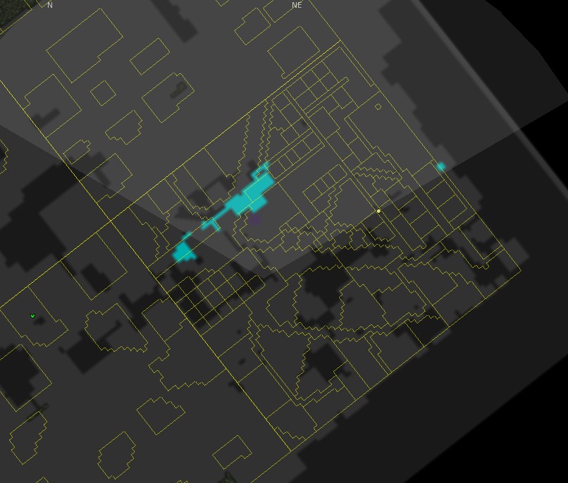
The quickest way to observe the plan is to open the Mini-Map feature, which shows the parcellation of the territory:
While we do not see mass on this map, we can see that there is a coexistence of a reticulated plan on the N and E side of the sim, corresponding to the walled city, while the remaining territory is more freely parcelled — these are the woodland parcels. We can see larger parcels inside the city limits that correspond to the larger civic spaces, such as the Marktplatz, the Schloss and the Kirche. But generally, inside the walls the scale of the urban fabric is quite small. The reticulation arises from the module of the SL territory combined with the small scale. For a long time, this severely constrained the layout, but efforts are underway (the Densification) to break that legacy, using prim pooling and smart linksets to decouple the built environment from the system module.
The straightness of Talenstrasse can be seen in the map: the yellow dot marks my position just outside 1165.
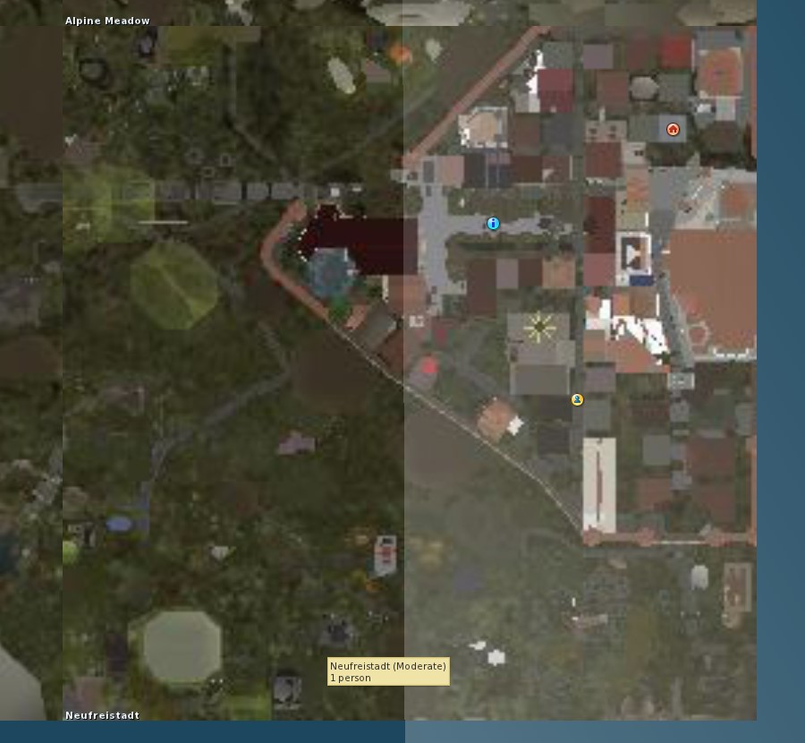
To keep using the immediate tools of the platform, I am pasting the World Map view below. World Map shows the built mass. I am still standing just outside Talenstrasse 1165 (yellow dot again). North is up, and the grey larger-scale building directly NW of me is the MoCA. 1165 is the dark-grey roof just left of me.
I would like to use #2.Site as a means to discuss several issues that have been crossing my mind as I go on about the Query. One thing which is a very salient question is: how do you approach the site? When you teleport into NFS using the World Map, you’ll arrive on the blue dot at the Platz. Then you need to choose how to reach the site: either walking or flying, both are equal ways of dislocation in SL. Not to go into the weeds of the ‘fifth façade’ discussion, but it is interesting to observe how the perception of space changes when you fly. Landmarks like the MoCA gain a completely new importance in the fabric because they are the landmarks to fly to. My orientation suffers when flying (not sure if this is common), so the existence of these landmarks is very important for my ETAs 🙂 And actually, from the ground, unless you are at an open space like the Platz, you may miss the MoCA as it extends above your camera limits as you walk by. Inversely, when flying over the city you are flying over roofs which, from above, look pretty similar. So whatever is distinctive from the street may not be so from above, and the other way around as well. This, of course, happens in RL as well! My perception of a RL street is different when I am standing on it or when I am watching it from the third floor. But in most cases in RL there is an intermediate experience between the two moments of perception. Architecture, of course, has always curated and manipulated these mediation experiences. In SL, the transition between the two perceptions happens on-the-go, dynamically and dramatically.
On my production for #2.Site, I had then to choose a preferred point of view, and I have chosen ‘from the ground’… My reasons for this choice are somewhat murky. As you walk by on the streets you get to meet the other residents and get insights from their places… maybe this is a useful anchor in a place with so many degrees of freedom! In any case, I feel that it is important to keep in mind the dynamic nature of the transition between perceptions.
So I have chosen the ground as my preferred point of view, and I have walked to and around the site. Another issue then arises: the freedom of the camera. Now, I admit that I am always moving the camera! And this creates a rather similar experience again: you can be firmly on the ground but be moving the camera about so that the moments of perception succeed quickly and without mediation. This obviously, happens if you are still; when you walk the camera resets to a moving point above the head, the default view. It is also possible to force the subjective view by keeping to Mouselook view (camera is behind the eyes). But as using the interface becomes rather clunky in Mouselook, it happens that you are constantly exiting it back into default view — and again the point of view changes instantly! So… in the midst of these ever-changing perceptions I can only reach the conclusion that there are no favoured points of view in the virtual territory. Everything can be seen from all angles at all times, and the object to be created needs to respond to that.
I find that the surroundings of the site are mainly characterized by their density and by the tension between the scale of the MoCA and the scale of the rest. Now, the Densification allows for larger new buildings, and this is already apparent nearby, but actually this bit of Talenstrasse mainly keeps the old scale.
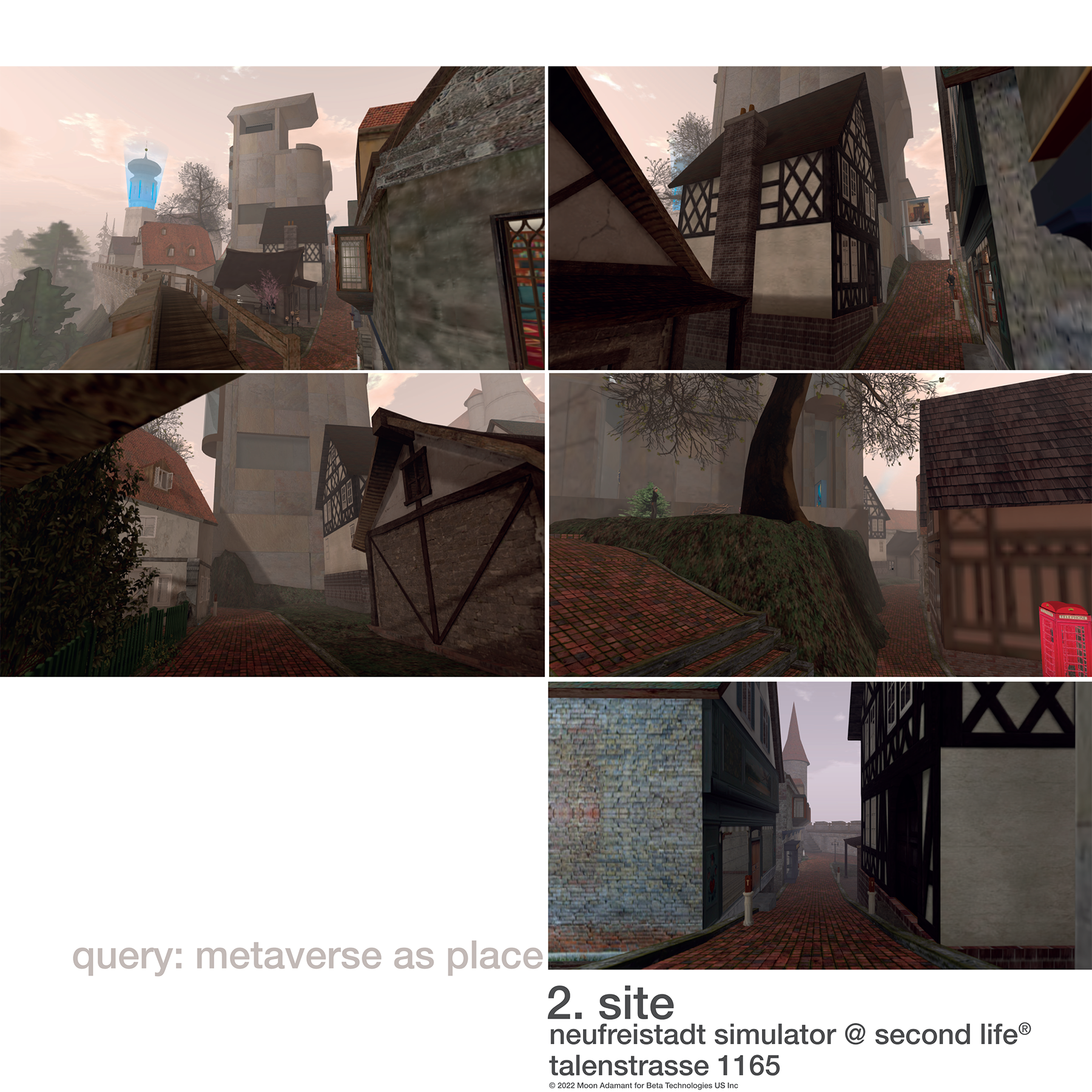
In the photos, Talenstrasse 1165 is shown to actually have two fronts, the back of the parcel being accessible from Gwynethstrasse as well. There is a difference of levels between the two streets, measuring over 3m at the highest point on the steep Talenstrasse front. The parcel is occupied at the moment by Dianne Mechanique’s Small Black Fachwerk. The fachwerk has been optimized by Rosie Gray to a remarkably efficient, sharply-texturized building, while keeping the original form and dimensions. My main issues about the fachwerk relate to its form, which does not adapt easily to the topography and built surroundings: it leaves odd interstitial spaces to its south neighbour, and to the MoCA wall. While interstitial spaces can and do exist elsewhere, the ones here do not add value either to the built environment, or to the public space. And actually this can become an interesting challenge for the project. The fachwerk also does not deal with the difference in levels, though admittedly that could be resolved in its current form with either a terraced space on the back or with a sunken access on the front. Still, an interesting challenge for the Query would be that its form would intrinsically solve the level difference AND add value to the interstitial spaces.
But the main agents in the site are the scale, the mass and the beautiful, tactile blank façade of the MoCA. The MoCA creates such a singular tension on the space that it is creating disruption in the city fabric by itself, such as the high terrain and huge tree over Gwynethstrasse. For scale, 1.80m-tall me can barely be seen in the photo. This disruption is a very interesting moment in the city — I believe the Query can profit from stablishing a relation to it. Also, the MoCA stands freely on its other 3 fronts, while on this south side the proximity to the fachwerk is challenging to both, and it does feel some remediation is needed.
Talenstrasse’s small scale, and the towering mass of the MoCA also result in a feeling of enclosure. This resolves somewhat on the south end of the street, just one building away, as the street meets Gwynethstrasse and the angular insertion of the city wall creates some breathing room, though closing again — it’s a walled public space. Again, the interstitial spaces around 1165 do not contribute to any relief of the tension, and it would be interesting to address that in the Query as well.
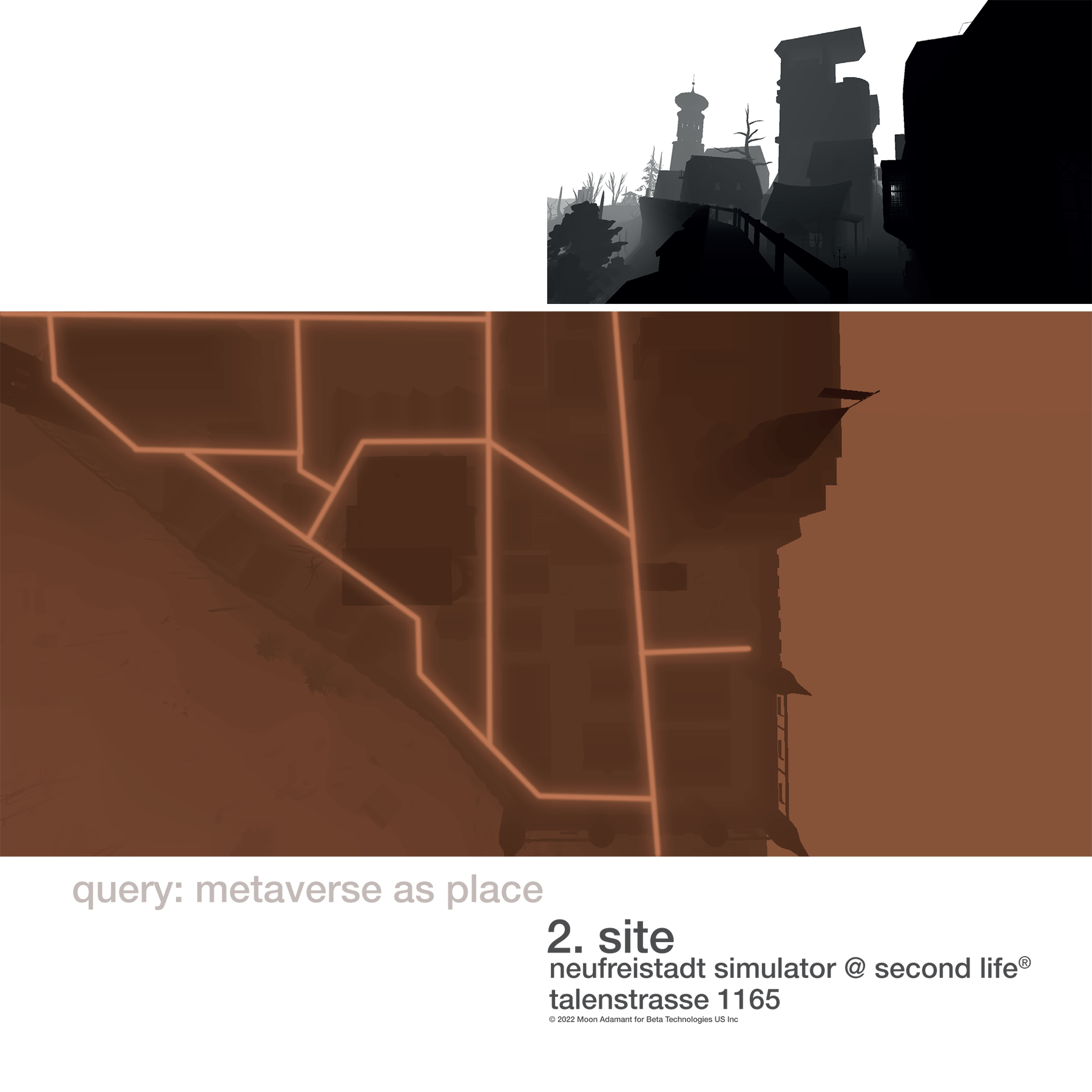
Second Life has another very cool feature. When taking a snapshot, I can choose that it portrays depth instead of colour, and it devolves images like those just above. The images do make a distinction according to the closeness to the camera point of view, and thus we see that the spires of Schloss and city walls, and the top of Moca, are tinted in a darker tone. It should be noted that low LOD builds that fail to render as the camera zooms out do not appear in either image mode, and thus the aerial view lacks the neighbour to the south. Still, this allows a immediate analysis of mass and void, which I generally integrate, as I am always interested in the experience of void, be it public space or skyline. Also, these images are appealingly sharp and so good bases for communication. I have used the aerial depth map to mark down a matrix of directions on the ground — this result was achieved very quickly indeed, even allowing for a good bit of experimenting with the graphic language.


